There are a lot of misconceptions online regarding the Mongolian landscape, so we decided that a Mongolia-centred blog ought to settle the matter the best way possible – by providing facts in a comprehensive and interesting manner. Learn about the Mongolian steppes, deserts and everything in-between on this page.
Geography
The nature of Mongolia is much more diverse than it’s perhaps thought of. Yes, the country is rightfully known for its enormous plains, but Mongolia is not exactly the Netherlands; quite on the contrary, the Asian country is home to four mountain ranges.
With this little statement, we wanted to show you how wrong the geographical stereotypes are. Now we can begin our lesson.
Territory and Borders
Mongolia is a country in Central and East Asia, situated at approximately 41° and 52° N and 87° and 120°E. Mongolia is landlocked (the biggest landlocked country) and it borders China to the south and Russia to the north.
It spawns over 1,564,116 km2 (603,909 square miles) with 2400 km from east to west and 1260 km from north to south, making it the 18th biggest country in the world. Despite its enormous size, its population numbers a little over 3 million (3,278 million to be exact), thus being the most scarcely populated country on the globe with about 2 people per km2.
Geographical Regions
Mongolia can be separated into four geographical regions (from north to south):
- The Mountain Region
- The Steppe
- The Desert
- The Semi-desert
Returning to the statement we made earlier, not only is Mongolia not flat, but in fact most of it is mountainous. Moreover, most of Mongolia is elevated with many towns and cities sitting at approximately 1,500 m above sea level.
The first region is the biggest out of the four and it comprises of four mountain ranges, which make for a very secure border with their northern neighbour Russia. These four ranges are the Altai Mountains in the west (west to southwest), the Khangai Mountains in central Mongolia (central to north), the Khövsgöl Mountains in the north, and the Khentii Mountains in the northeast.
The Altai Mountains are the highest of the bunch with their highest peak, Khüiten Peak, standing proud at 4,374 m. The Khanagai Mountains occupy most of central Mongolia, and they are older and thus lower than the Altai; they are characterised by vast alpine pastures and luscious forests.
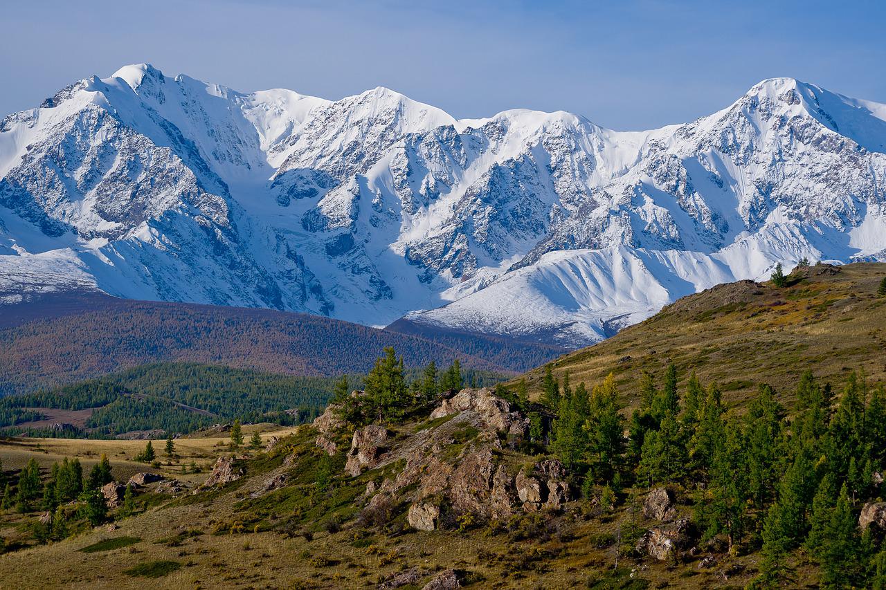
The Khövsgöl Mountains are relatively young, and they have Alpine characteristics, similarly to the Khanagai Mountains, with high peaks. Last, but not least, the Khentii Mountains that spawn over central and north-eastern Mongolia are home to the impressive taiga with numerous lakes and rivers flowing through it. It’s also where the Mongolian capital, Ulaanbaatar is situated.
The second region is of course the most famous one – the steppes. It’s safe to say that we’ve all pictured the Mongols riding on their horses along the great steppes, and while we proved that Mongolia is in no way a plains-only country, the steppes make a big portion of the land and there still are a lot of people leading a nomadic or semi-nomadic life there (thought to be 30% of the total population).
The steppes cover big portions of central and eastern Mongolia and they’re part of the larger Mongolian-Manchurian grassland that crosses Mongolia, Russia, and China. The Mongolian steppes are some of the best-preserved natural lands in the world because of the nomadic way of life that their inhabitants lead.
The ecosystem of the steppes is thus in perfect shape and balance. Some of the fauna includes rare animals like the Mongolian gazelle, corsac foxes, Pallas’ cats, Daurian hedgehog, steppe eagle, and Amur falcon, among others.
The third geographical region is the semi-desert, the Alashan Plateau semi-desert, which starts at the Altai Mountains and ends in northern China. Although much of the land is barren, you can still find flora and fauna in the region.
The last and one of the vastest regions in Mongolia is the desert one that encompasses the Gobi Desert, which is the sixth biggest desert in the world. It is mostly comprised of rocks and cliffs, but you can also find dunes. Gobi is divided into “desert proper” and rangelands. Gobi is a rather cold desert and if you’re lucky, you can see dunes covered in snow.
Climate
Despite how big Mongolia is, its climate is surprisingly not that diverse. Mongolia’s climate is strongly continental meaning that there are hot summers and cold winters, with summer being shorter than in other countries in the same climate category.
The average summer temperature is between 10 to 26° C, and the average winter temperature is between 15° C to – 30° C, although you can often see higher and/or lower temperatures. The desert region is naturally warmer, while the mountain region – colder.
The temperature varies greatly on the region, but even one region can have very unpredictable weather. This greatly affects agriculture, while permafrost makes it near impossible to build lasting infrastructure or support mining. For instance, there’s even a term for a winter that leads to massive livestock deaths – zud.
In terms of rain, the northern part of the country receives much more rain than the southern part, with some regions (e.g., the desert one) having almost no rain at all.